Thursday, May 29, 2008

Tropical Depression One-E

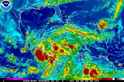
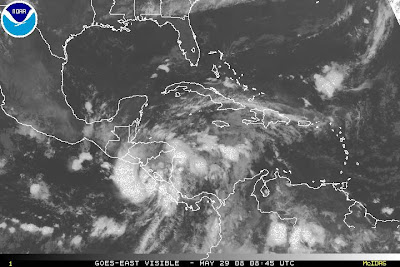
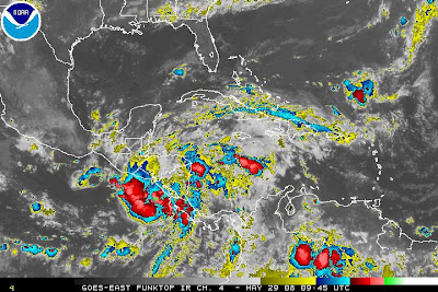
A tropical depression has formed just south of Nicaragua and looking pretty impressive on satellite. This system is forecasted to strengthen to a mild tropical storm before it makes landfall in Nicaragua/Honduras/EL Salvidor. Here is the latest satellite.

H10
Wednesday, May 28, 2008

! Special Tropical Weather Post ! on the E-PAC

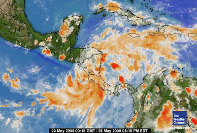
INVEST 90E has developed in the EPAC. Most of the models show INVEST 90E continuing to drift north and hit Nicaragua, EL Salvidor, or Guatemala. This storm continues to look impress on satellite and may contain VERY HEAVY RAINS and may cause FLOODING. This storm also could reach Tropical Depression statues before making landfall. Here is the latest satellite image.

1. Courtesy of The Weather Channel

H10

Thursday, May 22, 2008

Hurricane Season

Hurricane season official starts in 9 days. NO tropical weather formation is expected for the next 48 hours. I might have a report from Cape Canaveral, Florida on The 31st or June 1st. I will have to see what computer access I have. Recent runs of the GFS and ECMWF Show that there could be possible development of a tropical depression or a tropical storm in the Eastern Pacific just off the coast of Guatemala May 28/29.
If such storm developes i will most likely post a Special Tropical Weather Post or STWP.

H10